Scientists at McMaster University and the Massachusetts Institute of Technology have used artificial intelligence to discover a new antibiotic that could be used to fight a deadly, drug-resistant pathogen that strikes vulnerable hospital patients.
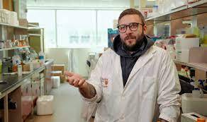


Scientists at McMaster University and the Massachusetts Institute of Technology have used artificial intelligence to discover a new antibiotic that could be used to fight a deadly, drug-resistant pathogen that strikes vulnerable hospital patients.
Their process could also speed the discovery of other antibiotics to treat many other challenging bacteria.
{media load=media,id=312,width=480,align=left,display=inline}
The researchers were responding to the urgent need for new drugs to treat Acinetobacter baumannii, identified by the World Health Organization as one of the world’s most dangerous antibiotic-resistant bacteria. Notoriously difficult to eradicate, A. baumannii can cause pneumonia, meningitis and infect wounds, all of which can lead to death.
A. baumanni is usually found in hospital settings, where it can survive on surfaces for long periods. The pathogen is able to pick up DNA from other species of bacteria in its environment, including antibiotic-resistance genes.
In the study, researchers report they used an artificial intelligence algorithm to predict new structural classes of antibacterial molecules and identified a new antibacterial compound, which they have named abaucin.
Discovering new antibiotics against A. baumannii through conventional screening has been challenging. Traditional methods are time-consuming, costly, and limited in scope.
Modern algorithmic approaches can access hundreds of millions of molecules with antibacterial properties, possibly billions.
“This work validates the benefits of machine learning in the search for new antibiotics,” says Jonathan Stokes, lead author on the paper and an assistant professor in McMaster’s Department of Biomedicine & Biochemistry, who conducted the work with James J. Collins, a professor of medical engineering and science at MIT, and McMaster graduate students Gary Liu and Denise Catacutan. 
“Using AI, we can rapidly explore vast regions of chemical space, significantly increasing the chances of discovering fundamentally new antibacterial molecules,” says Stokes, who belongs to McMaster’s Global Nexus School for Pandemic Prevention and Response.
“AI approaches to drug discovery are here to stay and will continue to be refined,” says Collins, Life Sciences faculty lead at the MIT Abdul Latif Jameel Clinic for Machine Learning in Health. “We know algorithmic models work, now it’s a matter of widely adopting these methods to discover new antibiotics more efficiently and less expensively.”
Abaucin is especially promising, the researchers report, because it only targets A. baumannii, a crucial finding which means the pathogen is less likely to develop drug resistance rapidly, and which could lead to more precise and effective treatments.
Most antibiotics are broad spectrum in nature, meaning they kill all bacteria, disrupting the gut microbiome, which opens the door to a host of serious infections, including C difficile.
“We know broad-spectrum antibiotics are suboptimal and that pathogens have the ability to evolve and adjust to every trick we throw at them,” says Stokes. “AI methods afford us the opportunity to vastly increase the rate at which we discover new antibiotics, and we can do it at a reduced cost. This is an important avenue of exploration for new antibiotic drugs.”
Wilmer Eye Institute, Johns Hopkins Medicine researchers say they have used artificial intelligence models and machine-learning algorithms to successfully predict which components of amino acids that make up therapeutic proteins are most likely to safely deliver therapeutic drugs to animal eye cells.
The project, a collaboration with researchers from the University of Maryland, holds promise for advancing new and more tolerable drug treatments for common chronic blinding eye diseases, including glaucoma and macular degeneration, which affect 3 million and about 20 million people in the United States, respectively. Current drug therapies for these diseases, consisting of multiple daily eyedrops or frequent eye injections, are effective, but such delivery systems may be difficult to sustain and tolerate over time and have encouraged scientific efforts to develop delivery systems that would bind to components of eye cells and safely extend the therapeutic impact of the medications they carry.
In 2020, the Food and Drug Administration approved an implantable device that can be placed in the eye and release drugs to treat glaucoma. While that device worked for longer periods than drops or injections, prolonged use was shown in some cases to cause eye cell death, requiring patients to revert to eye drops and injections.
The new research showed that artificial intelligence-designed models accurately predicted an effective sequence of amino acids, also known as peptides or small proteins, that would bind to a particular chemical in rabbit eye cells and safely dispense medications over several weeks, reducing the need for frequent, strict treatment schedules. The team specifically investigated peptides that bind to melanin, a compound that provides color to the eye but has the advantage of being widely present throughout specialized structures in eye cells.
The research team noted that other studies investigating drug delivery using peptides have shown how effective this system can be, but they wanted to find peptides that would strongly bind with a widespread eye compound. To do that, the team reasoned that rapid machine learning using artificial intelligence methods could help sort out and predict an effective peptide sequence to try, according to Laura Ensign, Ph.D., the Marcella E. Woll professor of Ophthalmology at the Johns Hopkins University School of Medicine, and co-corresponding author of the paper.
The team started by feeding a machine learning model thousands of data points, including characteristics of amino acids and peptide sequences. These data helped the computer model “learn” the chemical and binding properties of certain amino acid combinations, and in time, how to predict candidate peptide sequences for drug delivery using melanin.
The artificial intelligence model generated 127 peptides that were predicted to have varying abilities to penetrate the specialized cells that house melanin, bind to melanin, and be nontoxic to the cells. Out of these 127 peptides, the model predicted that a peptide called HR97 had the highest success rate of binding. The team also confirmed the properties of these peptides, including better uptake and binding within cells as well as no indication of cell death.
To test the model’s prediction, researchers attached HR97 to the drug brimonidine, which is used to treat glaucoma by lowering inner eye pressure, and injected it into adult rabbit eyes. To determine HR97’s performance, researchers measured the levels of brimonidine in the eye cells by testing the cells’ concentrations of the drug after administering the experimental drug delivery system. They found that high amounts of brimonidine were present for up to one month, indicating that HR97 successfully penetrated cells, bound to melanin, and released the drug over a longer period. Researchers also confirmed that the eye pressure-lowering effect of brimonidine lasted for up to 18 days when bound to HR97, and found no indication of irritation in the rabbits’ eyes.
Ensign says that future studies using artificial intelligence to predict peptides for drug delivery have huge ramifications for other conditions that involve melanin and can be extended to targeting other specialized structures.
“We believe we are well on the way to finding solutions in trying to improve patient care and quality of life using drug delivery systems. The ultimate goal is creating something that we can translate out of the lab and make people’s lives better,” says Ensign.
Moving forward, Ensign says, researchers will need to find ways to further extend the duration of action, test the success rate of the AI model’s drug delivery predictions with other drugs, and determine safety in humans.
Other researchers involved in the study are Henry Hsueh, Usha Rai, Wathsala Liyanage, Yoo Chun Kim, Matthew Appell, Jahnavi Pejavar, Kirby Leo, Charlotte Davison, Patricia Kolodziejski, Ann Mozzer, HyeYoung Kwon, Maanasa Sista, Sri Vishnu Kiran Rompicharla, Malia Edwards, Ian Pitha and Justin Hanes of the Johns Hopkins University School of Medicine; Nicole Anders and Avelina Hemingway of the Johns Hopkins Sidney Kimmel Comprehensive Cancer Center; and Renee Ti Chou and Michael Cummings of the University of Maryland.
This work was supported by funding from the NIH (R01EY026578, R01EY031041, P30CA006973, and S10OD020091), the Robert H. Smith Family Foundation, the Marcella E. Woll and Maryland E-Nnovation Initiative Fund to establish the Marcella E. Woll Professorship in Ophthalmology, Research to Prevent Blindness, a National Eye Institute Training Grant (T32EY007143), a National Science Foundation Award (DGE-1632976) and a National Center for Advancing Translational Sciences grant (UL1TR001079).
Hey there! We noticed you’re using an ad blocker.

